Simplify use of your data through Google MapsSave time on Staff Training & Data Entry
![Accede Maps](/_next/image?url=%2F_next%2Fstatic%2Fmedia%2Ffrontpageimg-1.12e05491.png&w=3840&q=75)
![Zoho](/_next/image?url=%2F_next%2Fstatic%2Fmedia%2Fzoho-logo.a078c2de.png&w=1920&q=75)
![Reckon](/_next/image?url=%2F_next%2Fstatic%2Fmedia%2FReckon-Logo.83c8007e.png&w=3840&q=75)
![MYOB](/_next/image?url=%2F_next%2Fstatic%2Fmedia%2FMYOB-logo.c3141c34.png&w=3840&q=75)
![Zapier](/_next/image?url=%2F_next%2Fstatic%2Fmedia%2Fzapier-logo.ab6a48dc.png&w=3840&q=75)
![Accede Maps Excel](/_next/image?url=%2F_next%2Fstatic%2Fmedia%2Fexcel-logo.514d4f0a.png&w=1200&q=75)
Integrations
Accede Maps integrates with over 1,500 applications through Zapier as well as a number of standard accounting packages directly.
Custom connections can also be made through its API.
What is Accede Maps?
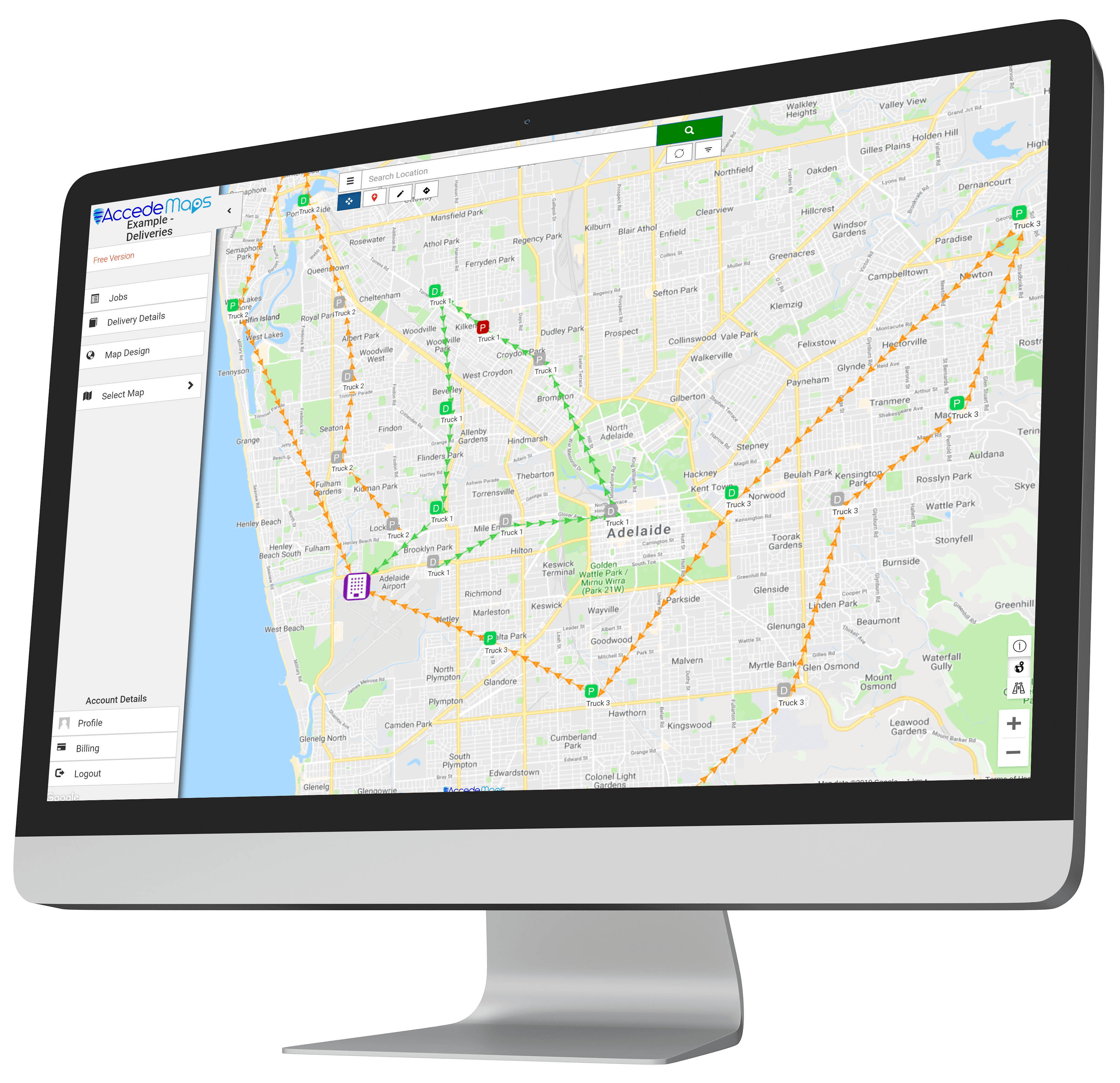
Accede Maps is a customizable Geographical Information System (GIS) that ties your database into Google Maps.
With its two-way integration, data modified on the map will automatically pass through to your main system.
This means less staff training time and lower license costs.
![Apex](/_next/image?url=%2F_next%2Fstatic%2Fmedia%2Fapex-australia-logo.cffd7932.png&w=640&q=75)
![Utter Gutters](/_next/image?url=%2F_next%2Fstatic%2Fmedia%2Futter-gutters-logo.18f53dd6.png&w=640&q=75)
![BIL](/_next/image?url=%2F_next%2Fstatic%2Fmedia%2FBIL-Logo.89b1997f.png&w=750&q=75)
![Transliquid](/_next/image?url=%2F_next%2Fstatic%2Fmedia%2Flogowithnumbers2.7e072a87.png&w=2048&q=75)